Mare Nostrum Migrant Project (2020)
Update: March 21, 2023
During a trip to Paris, February 2020, to meet with staff at the Louvre for my Biard research project, I encountered a faded and damaged map of the Mediterranean area in an art gallery. The artist was Sabine Rethore, a cartography artist who creates 90-degree rotated country maps and globes since the late 1990's.
Her rotated maps offer an interesting new perspective on the structure of countries. Viewers are placed 'on the wrong foot' and often need time to recognize
the orientation.
Being placed on the wrong foot also literally happens with many migrants, who try to cross the mediterranean sea in small and often not seaworthy boats, paying smugglers immense fees to travel to a life they expect is better on the other side. Many survive, and many don't.
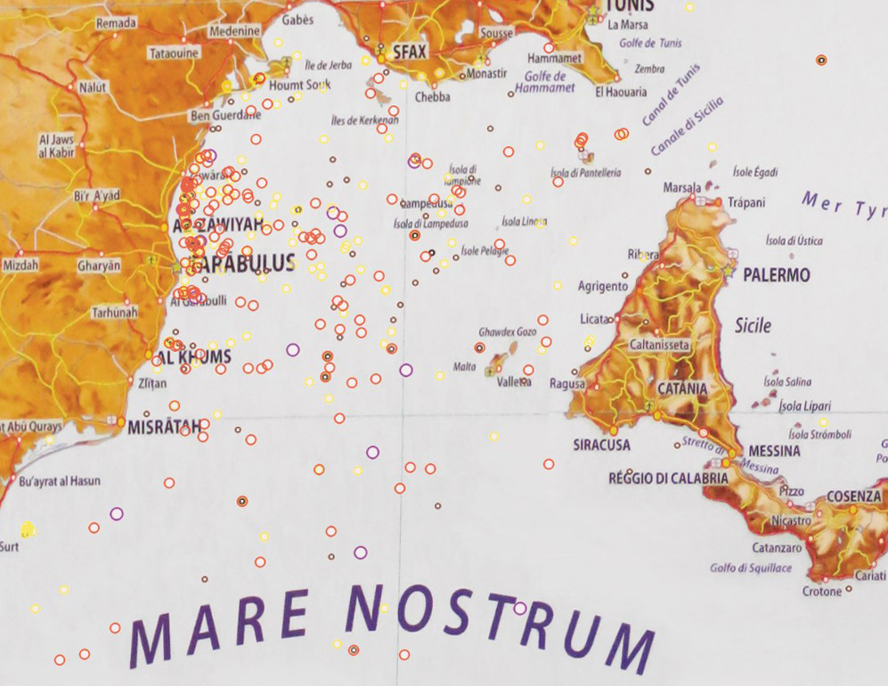
For this project I revived Sabine's Mediteranean map, and applied corrections in latitude and longitude to obtain an exact match with modern satellite images of the area to fit the global positioning system (GPS).
I subsequently embedded all missing migrant locations since 2014 into the map, using data from the International Organisation of Migration (IOM). The result is a map that not only stimulates the viewer to think about the geological and national aspects of the Mediterranean area, but also of their consequences for migrants and how to aid, and resolve these. A map with a story.
This page is under construction. Sample image below. Completion targeted for April 2022.